The climate the organisms feel

Short: in our recent review in Ecography, we propose an overarching approach to obtain microclimatic data for use in species distribution modelling. We now welcome anybody who has soil temperature data to join our SoilTemp-network and help us to apply the proposed techniques.

43035841140_9efb21663d_o.jpg

Ecologists like to know where species are living, and why. It is indeed one of the most critical questions in today’s ecology to ask what is behind the distribution of a species, and how that will be affected by global change. A highly popular tool in that regard are ‘species distribution models’ (SDMs), a statistical tool to link species occurrence data to data on background conditions.

Climate is a crucial background condition to consider in that regard, and climate variables are the most commonly used variables in SDMs. Yet there is a big issue there: what climate to use when modelling the distribution of a species? Ideally, one wants to use the conditions as experienced by the study organism, right? Traditionally, however, SDMs mostly rely on free-air temperature conditions with a coarse resolution (e.g. with pixel sizes of 1×1 km), as this has for long been the best data available. Such data however fails to capture the apparent temperature (cf. microclimate) as experienced by living organisms within their habitats.

42021202270_df77ed6003_o.jpg

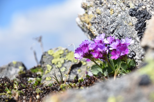
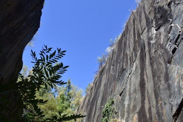
For mountain plants especially (in this case Pedicularis hirsuta in the northern Scandes), the climate they experience near the ground is far from what happens at 2m in the air.

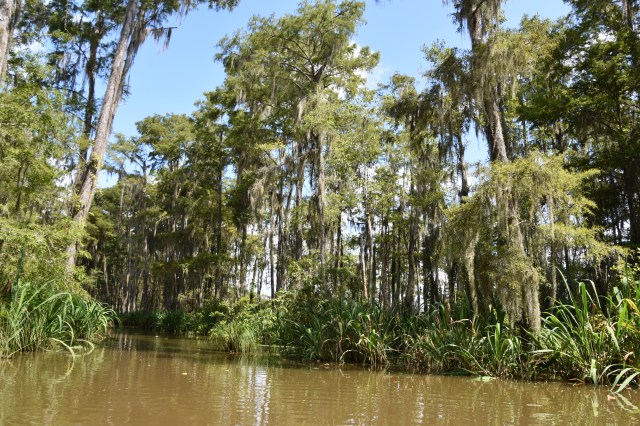
There is indeed an important mismatch between the climatic data we have available, and the climate as experienced by many organisms. First of all, local variation in temperature is crucial in any habitat with a vertical component, like forests, mountains, or cities. In these environments, local temperatures can differ several degrees from the coarse-grained averages usually used. Additionally, free-air temperature and climate patterns also differ significantly from what happens at the soil surface, or a few centimeters below it. For many organisms in the soil and close to the surface (soil micro-organisms, ground beetles, herbs, forbs, mosses or tree seedlings, for example), this mismatch is fundamental.

26998647151_2b32b3c5c8_o

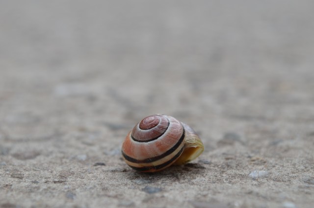
Most organisms, being it plants, insects, soil microbes or many many others, live totally decoupled from the climate at coarse resolutions as measured in weather stations. (Pictured: Cepaea nemoralis)

But no worries, the scientific community is on it! Several studies have already made considerable progress in tackling this problem from different angles in their effort to solve that mismatch. In our recent review in Ecography, we show how 1) in-situ climate measurements with tiny sensors, 2) remotely sensed data (from satellites, airplanes, or LiDAR, which provides high-resolution 3D reconstructions of the environment) and 3) microclimatic modelling, are all bringing us closer and closer to the climate our study organisms actually care about.

32686389013_dd04a71e93_o

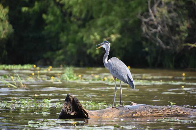
Several studies have been getting closer to modeling the actual climate experienced by species, for example by incorporating 3D-forest structures in models of climate on the forest floor. (Pictured: Crocus sp.

We believe that instead of using all these approaches separately, we should combine them. We thus propose a framework that does exactly that: first of all, we suggest using a selection of appropriately-placed sensors, spanning a wide range of environmental conditions. Not too few, not too many. This real-time local data from exactly the location where your organisms live can then be combined with detailed measurements of the habitat 3D structure, for example derived from digital elevation models or airborne laser scanning to extrapolate it to the whole region. Finally, long-term records of free-air conditions from nearby weather stations can be used to extend your in-situ network through time. With this unified approach, we can obtain microclimatic data with the optimal resolution and extent – both in space and time – to accurately model current and future species distributions.

Graph

Summarizing our framework on how to get relevant microclimate data for use in ecological models.

Yet the proof of the pudding is in the eating, of course. The framework is there, but now we are stepping up the game: we want to apply our concept on the global scale. Therefore we launched SoilTemp, which is a global database of soil temperature data, with a double purpose: 1) we want to model soil temperature globally, combining this database of in-situ measurements with remote sensing and microclimatic modelling, and 2), we want to use the database to improve our models of species distributions. More on that here.

Interested, and have some soil temperature data lying around? Don’t hesitate and get in touch!

33556874241_0eee4ec877_o

The concrete surface and tall buildings in cities create a unique microclimate that is highly different from large-scale climatic averages. (Pictured: Viola sp.)

Reference: 

Lembrechts JJ, Nijs I, Lenoir J (2018). Incorporating microclimate into species distribution models. Ecography. doi: [10.1111/ecog.03947].

Posted in General, Science | Tagged , , , , , , , , | Leave a comment

October 1st

Monday, October 1st, will mark an important milestone: that day I will officially start my 3 years as a postdoc funded by the Research Foundation Flanders (FWO).

42934179021_693674e6a8_o

Plants dealing with extreme environments (in this case a Primula in the Swiss Alps) stay an important topic of my postdoc.

I have spend the last few months preparing intensively for this day, and I feel I am more than ready to start turning words into deeds. I will use the trust put into me by the FWO and my host institution – the University of Antwerp – to improve our understanding of that very big question in ecology: why species live where they live (and not anywhere else).

19461506254_0e2d7cf18e_o

My postdoc will bring me back to the Andes in South America (here: a mountain lake in San Carlos de Bariloche, Argentina) to study the interaction between different plant species

The focus of these coming 3 years will lie on multiple fronts. First of all, there is the continuation of MIREN, the Mountain Invasion Research Network. We are still expanding the long-term plant species monitoring network in mountains, have a series of critical questions to answer on how interactions between species define their location, and have PhD-student Ronja dedicated to tackle the question how hiking trails in mountains affect plant species distributions.

29971193038_72cc0bd587_o

In the north of Scandinavia, mountain trails are the most visible disturbance of the landscape. We aim to disentangle their effect on the mountain vegetation.

Secondly, there is the microclimate work. In anticipation of this postdoc, we just launched SoilTemp, our ambitious attempt to build a global database of soil temperature data and apply it to improve our understanding of species distributions and traits.

42609580734_8262dc6190_o

We will be measuring a lot of stress on plants in a wide range of extreme conditions. Here: our Urban Heat Island-project in Flanders.

There is more, however. There is our work on Urban Heat Islands and how they affect the invasion of non-native species, the responsibility of Charly, a PhD-student in the University of Gembloux in Wallonia. And there is our dive under ground, to understand the mysteries of soil microbial communities, or the one into the wonderful realm of plant functional traits, or even those ideas on how remote sensing (satellites, or even 3D laser-scanning) can improve our understanding of where species live.

28064204007_32352f792a_o

Alpenrose (Rhododendron ferrugineum), another plant I’d hope to meet again within this postdoc project. 

So buckle up, as the ride is about to get a lot wilder again!

Posted in General, Science | Tagged , , , , , , , , , , , | 1 Comment

Topography (2)

In my previous blogpost, I highlighted the important effects of local topography on microclimate, and of the latter on species distributions.  I used a man-made structure, a slate quarry, as an extreme example. Now, I’d like to take you to an even more extreme, yet this time fully natural, example: the impressive cave of the ‘Gouffre de Padirac’ in the valley of the Dordogne.

20180919_154746804380235830322868.jpg

Asplenium scolopendrium, the hart’s tongue fern, growing at the very bottom of cave

This chasm is a big hole in the ground, 35 meters wide and 103 (!) meters deep, and the beginning of a long underground river system. This remarkable landscape element not only provides breathtaking views for those taking the old iron stairs (or elevator) down into its mouth, it also provides unique conditions for plant life.

20180919_1433365640548150751476951.jpg

The staircase that brought us down to the bottom of the ‘Gouffre’

Temperatures down in the grottes are a constant 13°C, which implies a rapid drop in temperatures over the 100 meter gradient. For plants living at the bottom – a surprisingly high variety of ferns, forbs, grasses and even shrubs and trees – it means a life with limited daily and even yearly temperature fluctuations, yet also very little light.

20180919_1814154521229092504744659.jpg

Beautiful stalactite formation in the caves

When wandering off further from the hole in the ground, ultimately the lack of light of course smothers any aspiring plant, but the unique conditions below the hole provide the ideal environment for plant species not very fond of neither high nor low temperatures.

20180919_142958620889378022619380.jpg

Higher up the slopes of the ‘Gouffre’, for plants it is also a battle for sufficient soil to grab on to, yet many remarkable plants managed even that very well.

Posted in France, General | Tagged , , , , , , , , , , | Leave a comment

Topography

For an ecologist interested in where plants are growing, the local climate is crucial. And that microclimate is for a large part influenced by the local topography. Slopes, aspect, elevation, cold air pooling… All the bumps and crevices in the landscape have a profound effect on the climate experienced by what is living there.

DSC_8670.JPG

The steep slopes of the slate mines in ‘Les Pans de Travassac’, Limousin

We got to experience a very clear example of these effects on our recent trip to the Limousin in Central France, where we visited one of the last remaining slate quarries in France.

DSC_8665

The artificial cliffs were often too steep for vegetation to cling to, but every rock has its hide-outs

In this magnificent landscape, history had turned an ancient ocean into slates, after which tectonic earth forces positioned these slates vertically. Then, centuries of slate mining cut out vertical holes in the rock with a depth of up to 150 meters (of which over a hundred under water).

DSC_8668

The artificial craters hosted a variety of shade- and cold-loving plant species

The result was a series of deep trenches, overgrown by vegetation wherever sufficient light was available. South facing tops of these artificial cliffs hosted sun-loving species, yet in the depths of the craters, shade- and cold-loving plants ruled.

DSC_8688

Especially ferns love such a cool and dark world, and even in the deepest holes, ferns of over a meter were a common sight.

DSC_8738

Polypodium vulgare, a species of fern that doesn’t mind some sun on its leaves, growing on top of the walls at the slate quarries

Interestingly, recent research has shown that such cool spots, where the microclimate is several degrees lower than in the surrounding environment, could be an ideal hide-out for species in times of climate change: while all around them the climate is heating up, species with an appetite for a cooler world retreat in these so-called ‘microrefugia’, where the remaining population might survive for a very long time.

DSC_8694

In this case, this could mean an unexpected positive effect of the human disturbance of the landscape.

Posted in France, General | Tagged , , , , , , , , , , , | Leave a comment

Mapping the trail survey

This summer has been highly successful for our MIREN trail survey. We can proudly present this map showing all the (approximated) locations where people have observed one of our focal plant species (red and white clover, common yarrow and narrowleaf plantain) along mountain trails.

abisko-autumn-24

Hiking trail in Abisko, northern Sweden

This map is a work in progress, of course, and we will be updating it while data keeps flowing in. We are currently still expecting observations from at least 200 more kilometers of trail!

With spring creeping up in the southern hemisphere, we will now switch our focus down under. This is thus a call for anybody who will be visiting mountains on the southern hemisphere to join the project and get your own star on our map! South American, African or Australian mountain enthusiasts, if you are lucky enough to be going out in the amazing nature, please think of us while you are there, and record the location of our study species if you happen to see them.

18554741104_566f4cb996_o

Even when you are lucky enough to see a guanaco on your hike through the Andes, don’t forget to look at your feet to check for our non-native plant species!

The southern hemisphere is of particular interest to us for this study, as all of our study species are either non-native there, or not (yet) present. This will help us comparing how their spread along mountain trails happens in both their native and introduced range, and which regions are currently invader-free.

All information on how to join can be found here.

Posted in General, Science | Tagged , , , , , , , , , , | Leave a comment

The Bayou

A little throwback post to the great time I had attending the annual meeting of the Ecological Society of America in New Orleans, beginning of August.

29030910307_39be32a25a_o

Alligator floating through the Old Pearl River in the Mississippi delta

You can read all about the theme of the conference, and how that made me feel very much at home, in this blogpost.

43250331784_d113087741_o

Old bridge over the Old Pearl river

Now, I just want to treat you to some pictures from the marshes, swamps and ‘bayous’ of the Mississippi delta, one of the natural wonders Louisiana and New Orleans are famous for.

43920503122_268121cb5f_o

The green wonders of the Louisiana bayou

As I learned on our little boat trip during our half a day break from the conference, a bayou is a slow-flowing river in the flatlands. What I also learned, is that it often hosts a variety of fantastic animals.

30100357078_d49f6f9745_o

43968831211_77b3de65e4_o

Curious raccoons

A more important thing we learned, unfortunately, is that Louisiana is experiencing rapid wetland loss in its coastal area, as a result of large-scale attempts in the last decades to get water levels under control.

43063455195_fc31c22fd5_o

The bayous and marshes on the Mexican Gulf play a crucial role as coastal protection.

One of the devastating results of this rapid wetland loss is a much higher vulnerability for storms and hurricanes, which brings us back to the main theme of the conference: with weather events observed and predicted to become more extreme, and humans increasingly disturbing the landscape, the negative impacts of global change are bound to accelerate in the near future.

43920448032_75d677b9b8_o

Alligator

You feel that when you are floating on the slow waters of the bayou, I can assure you. And you just hope these natural wonders are here to stay for a very long time.

43063436715_72da4b2200_o

A heron hunting for fish

29030913677_941655cc9d_o

Alligator munching on marshmallow snack

Posted in General, USA | Tagged , , , , , , , , , , , , | 5 Comments