
It was the year 2005. A group of mountain ecologists gathered in Vienna, Austria, for what would turn out to be an appointment with history. Their topic? Plant invasions in mountains! A consensus was soon reached that there was an important research gap to fill. While the overall view was, up till then, that mountains had been spared from invasion by non-native plant species, global change and increasing land-use pressures in mountains across the globe were rapidly changing that reality. However, there was very little global information on these patterns, with only a fairly recent regionally scattered literature emerging. Time was ripe, so they decided on a globally coordinated protocol. The Mountain Invasion Research Network (MIREN) was born.
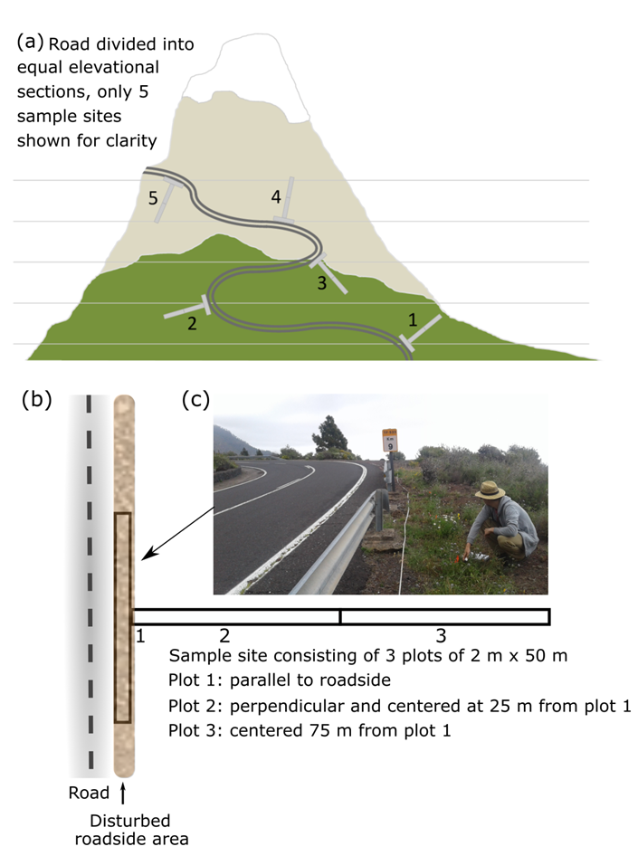
The next year, the team gathered again in Oregon, and it is there that the MIREN road survey protocol saw the light of day. The idea was to monitor non-native plant species along mountain roads, with a standardized survey design in the form of a T, and repeat that survey every five years – till eternity, so one might hope – to get the critical baseline information on how quickly non-native species are spreading along mountain roads.
Soon after, the protocol got expanded, and now it includes native species as well, allowing the study of range shifts of all plant species along elevational gradients, and the impacts of climate and roads on these, over time. In a recent paper, published in the open access journal Ecology & Evolution, we finally present the survey methodology and the summary of achievements to the world, hoping that it can become a standard monitoring tool in mountain regions across the globe.
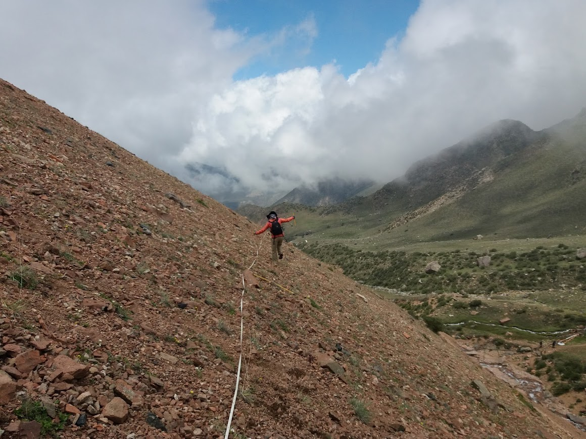
What we present is a conceptually intuitive and standardized protocol developed by the Mountain Invasion Research Network (MIREN), designed to 1) systematically quantify global patterns of native and non-native species distributions along elevation gradients and 2) shifts in these distributions arising from interactive effects of climate change and human disturbance. Usually repeated every five years, surveys consist of 20 sample sites located at equal elevation increments along three replicate roads per sampling region. At each site, three plots extend from the side of a mountain road into surrounding natural vegetation, in the characteristic T-shaped design. In each of these plots, presence, cover and abundance of all vascular plant species are noted down.
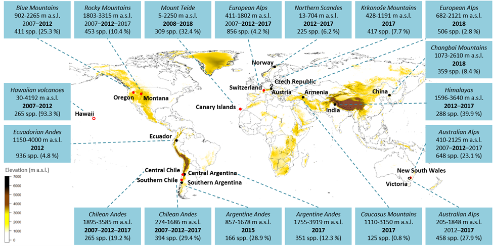
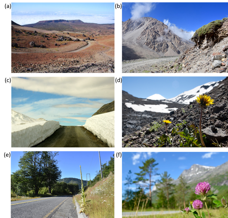
The protocol has been successfully used in 18 regions worldwide from 2007 to the present. So far, analyses of the data already generated salient results, both in regional studies and global assessments. For example, we found region-specific elevational patterns of native plant species richness, but a globally consistent elevational decline in non-native species richness. Non-native plants were also more abundant directly adjacent to road edges, suggesting that disturbed roadsides serve as a vector for invasions into mountains. From the upcoming analyses of time series – in some regions we now have three timesteps, over a 10 year period, and the 4th one will be collected this year – even more exciting results can be expected. Indeed, as the covered time frame gets longer, our assessment of species range changes will further improve.
Think all of this sounds fun and important? Perhaps you can join us!
Implementing the protocol in more mountain regions globally would help to generate a more complete picture of how global change alters species distributions. By publishing our protocol for all to read, we hope to enthuse the global ecological community to join forces with us and apply the protocol in your own region. With the MIREN protocol, you would have a unique tool in hand to monitor the impact of climate, climate change and anthropogenic disturbance on the vegetation in your mountain, with interesting patterns bound to emerge from the first sampling onwards. Feeding your data into our increasingly large database can then generate interesting comparisons about how your region compares to plant species diversity patterns in mountain regions across the world. This information can – and already does – inform conservation policy in mountain ecosystems worldwide, where some conservation policies remain poorly implemented.


")


")
")


")


")


")


")


")


